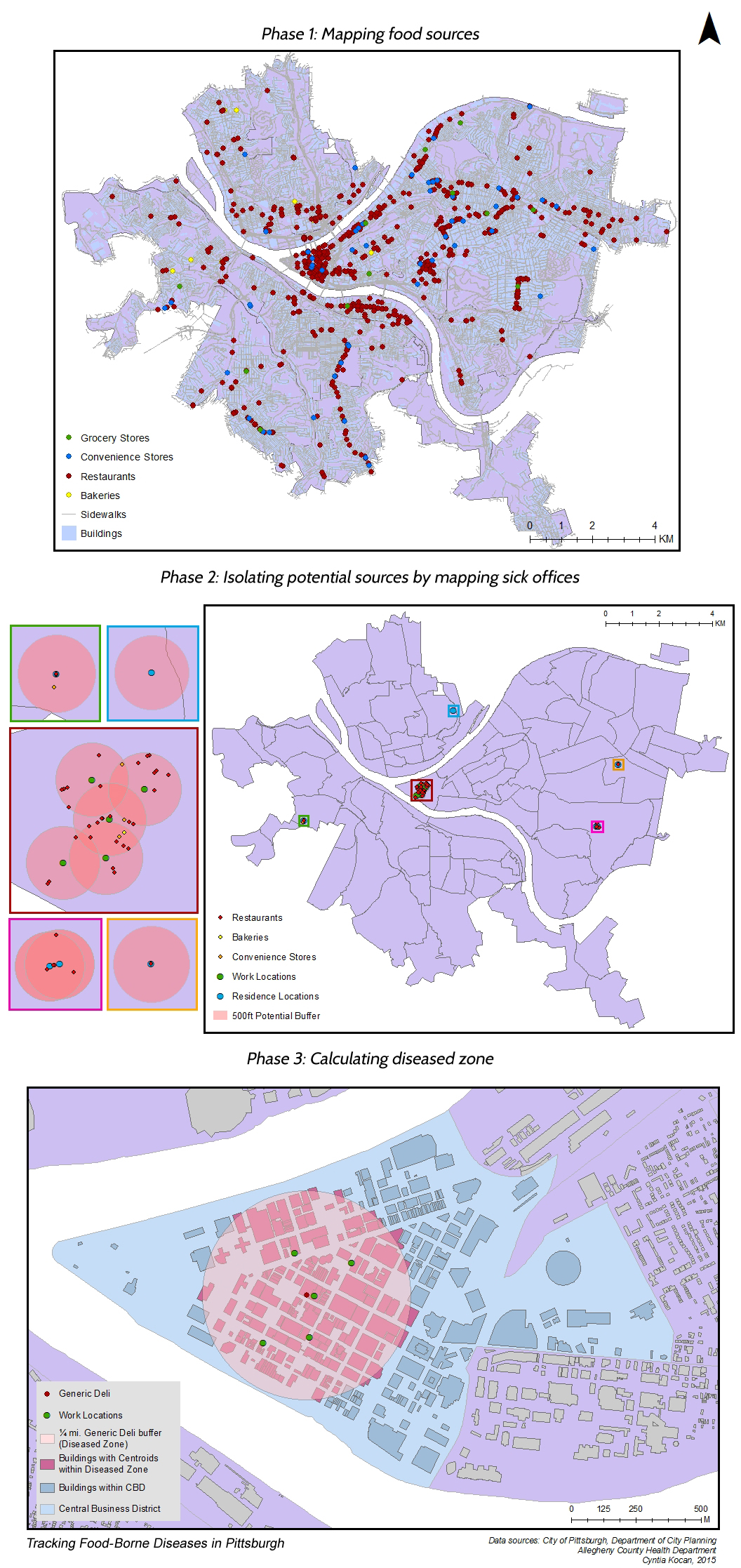
A project that tracks down the source of food-borne diseases in Pittsburgh.
Phase 1 maps all food sources in Pittsburgh using ArcGIS's address locator.
Phase 2 clips a 500m buffer around the office and residence of individuals poisoned.
Phase 3 isolates the 'diseased zone' and triangulates the most likely culprit of the food-borne disease.
- Categories:
- Share Project :